
Download the current Ride Across Arizona Touring Edition route HERE.
THE ROUTE:
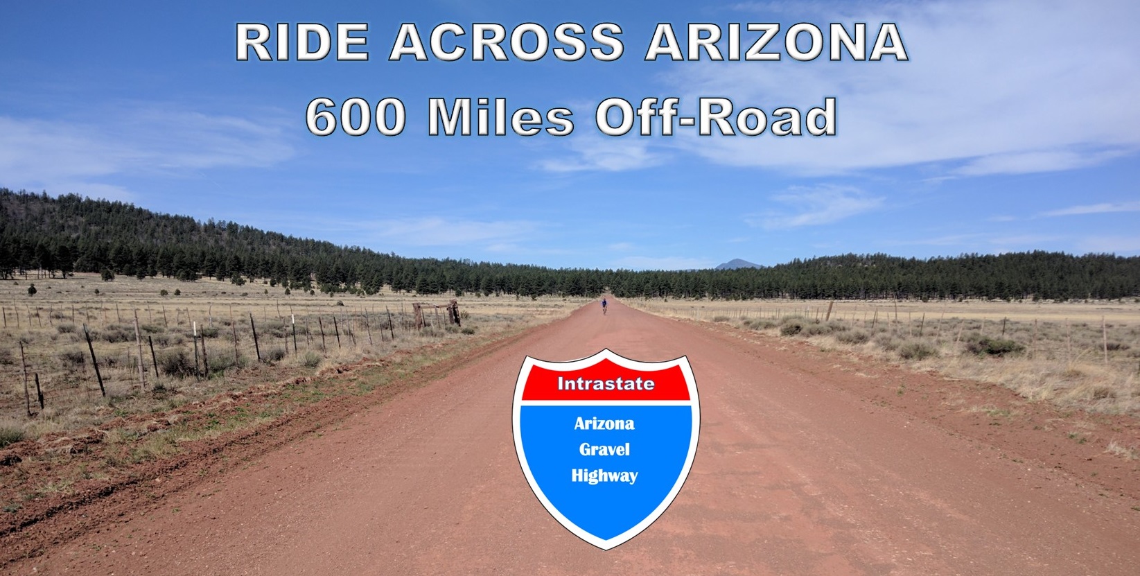
The 616 mile Ride Across Arizona is a cross-state adventure ride that we documented in 2020. The route is made up of non-technical dirt, gravel and forest service roads with less than 20% of the route being pavement. The western end starts on the Colorado River at the California/Arizona border from the historic river settlement of Topock and finishes at the New Mexico border near the remote outpost of Blue Arizona. By the time you arrive at the finish you’ll have crossed deserts, windswept mesas and several mountain ranges. Unless you plan otherwise no one will be there to greet you at the finish, it is remote!
The Ride Across Arizona traverses through a cross-section of Arizona defined by spectacular scenery, a variety of landscapes, historic towns and remote wilderness. You’ll ride along the Colorado Plateau, the Mogollon Rim, San Francisco Peaks, White Mountains and Blue Primitive Area not to mention riding remote sections of the National Old Road Trail and Route 66. There are numerous campgrounds along the way and hotels can be found along the route at Seligman, Williams, Flagstaff, Forest Lakes and Show Low. The finish is near the beautiful Town of Alpine which has numerous places to stay.
Since 2021 my wife and I have made this a yearly ritual where we start at sunrise (6:00am) from Topock on the Cali border on the first Monday in May and ride non-stop until we reach the New Mexico border near Blue Arizona. This seems to be the best time of the year to ride. The temps are not to bad in the deserts and generally the forest service roads and campgrounds are open the 1st of May for the start of the summer season. Anyone is welcome to join us as long as they understand that this is NOT an organized or sanctioned ride in any way. Each rider is responsible for their navigation and well being. There is NO PARKING at the Topock Route 66 Bar, this is just a convenient meeting place for the start located directly on the river.
RIDERS THAT HAVE COMPLETED RAAZ
Finishers (Solo Self-Supported):
Tyler Arnett 2d10h53m 2025 (ITT) (FKT)
Dana Ernst 2d19h42m (ITT) 2024
Daniel Connell 2d23h00m 2024
Dexter Kopas 3d08h57m 2022
Bryan Reid 3d16h15m 2024
Bryan Reid 3d22h55m 2023
Jason Reamy 4d07h02m 2022
Ethan Albrecht 4d08h03m (ITT) 2025*
Dylan Turner 4d09h16m (ITT) 2025
Ashley Wedelich 4d10h38m 2023 (FKT)
Lauren Brownlee 4d12h03m 2022
Simone Bailey 4d20h12m 2022
Paul Kuzdas 5d03h11m 2023
Mike Sowers 5d11h12m 2023
Patrick White 6d12h37m 2024
Matt McDonnell 6d22h47m 2024
Ryan Lay 7d06h57m 2024
Jeff Wheless 7d07h57m 2024
Ian Crombie 7d11h58m (ITT) 2022
Jenny Kelly 7d13h46m 2025*
Brian Berry 8d07h35m 2023
Mike Ingram 9d10h50m 2023
Finishers (Solo Supported):
Harry Johnson 4d13h01m (FKT) 2022
James Helms 5d08h25m 2024
Eric Pearce 5d12h55m 2023
Harry Johnson 7d12h51m 2021
Dan Wolf 7d12h51m 2021
John Wyatt 8d09h54m 2025
Craig Swetel 8d11h48m 2022
Jim Geray 9d07h37m 2022
Mike Enfield 9d13h32m 2022
Minnie Swetel 12d14h42m 2021 (FKT)
Finishers (Self-Supported Duo):
Christopher Schmidt 4d05h16m (FKT) 2022
Jay Petervary 4d0516m (FKT) 2022
Joe Pavlik 6d06h40m (ITT) 2024
Nathan Franklin 6d06h40m (ITT) 2024
Jennifer Hanson 6d14h06m 2022
Jason Hanson 6d14h11m 2022
Finishers (Supported Duo E-Bike):
Team AZ Gravel 6d10h01m 2024 (FKT)
Finisher (ITT Self-Supported East to West):
Billy McMillen 4d23h13m (ITT) 2022*
2021 Course Distance: 615 miles
2022 Course Distance: 620 miles
2023 Course Distance 610 miles
2024 Course Distance 616 miles
2025 Course Distance 616 miles
* Denotes course altered for death mud