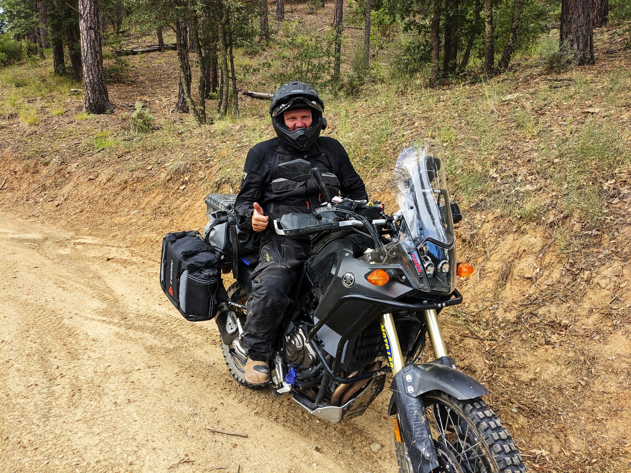
Each of these routes are perfectly suited for just about any mode of exploring: bicycles, 2WD/4WD vehicles, Side By Sides and especially Adventure and Dual Sport Motorcycles.
To obtain an up to date gps file for any of the routes listed below please send an email to ridingazgravel@gmail with the route name in the subject line. If you like the content of this page or the free routes featured on this website and want to say thanks you can buy me a coffee!
https://www.buymeacoffee.com/azgravel
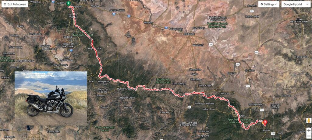
Trans-Arizona Off-Road Highway (AKA Ride Across Arizona)
The 630 mile route is made up of non-technical dirt, gravel and forest service roads with less than 20% of the route being pavement. The western end (suggested direction is west to east) starts on the Colorado River at the California/Arizona border from the historic river settlement of Topock and finishes at Alpine, Arizona. Before arriving at Alpine signs will indicate that you’ve briefly entered New Mexico before re-entering Arizona just in time for the final climb to the finish in Alpine. It starts at the Topock Route 66 Resort and finishes at Ye Olde Tavern in Alpine. The route features several alternatives to avoid sections that become impassable (death mud!) after heavy rains.
Best times of year: May thru October
Rating: Intermediate
The Arizona Divide
Most people have heard of the Continental Divide but did you know that Arizona has its own divide? The 280 mile Arizona Divide explores the tipping point where water will either run north or northwest into the Colorado River watershed or south or southwest into the Gila River watershed. So water on one side might flow into the Little Colorado River and be sent plunging over Grand Falls or crashing through the rapids near the Grand Canyon. Water on the other side of the divide might flow over the beautiful red rocks of Oak Creek Canyon or wind its way through the Salt River reservoir lakes, from Roosevelt to Saguaro, before winding up in the Gila.
Best times of year: May thru June, September thru October
Rating: Novice to Intermediate
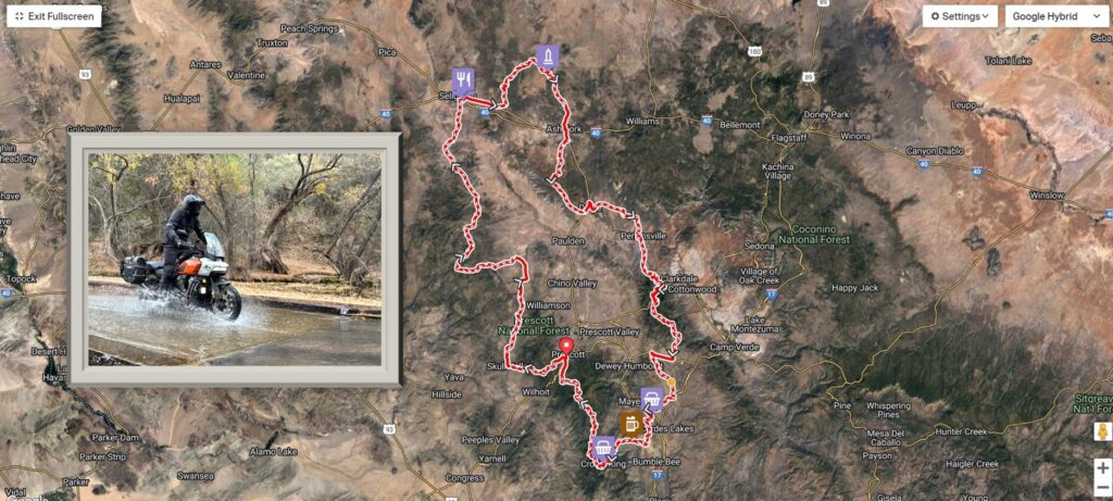
Yavapai Adventure Loop
Roll out of the famous Whiskey Row in Prescott for a 330 mile loop around one of Arizona’s original counties. You’ll ride along sections of Old Route 66 and the original Ocean to Ocean Highway, the National Old Trails Road, built in 1921. You’ll also visit numerous ghost towns and old mining towns like Jerome and Crown King. Much more on the history of this route can be found at Ride with GPS along with the current gpx.
Best times of year: March thru November
Rating: Intermediate
Northeastern Arizona
This 632 mile route starts out from Show Low Arizona and proceeds to take in some of the best that the White Mountains have to offer including Greens Peak, Greer, Big Lake, Hannagan Meadow and the east branch of the Black River. From there it’s on to Alpine and the backway into Nutrioso for a spin around Escudilla Mountain (3rd highest in the state!) before heading back to Alpine and down into the community of Blue along the Blue River. Then it’s a monster climb up and over Aspen Mountain as you enter New Mexico. This road is also part of the New Mexico BDR. After you arrive at Highway 181 you’ll enter Luna, New Mexico. Back onto dirt and the scenery starts to change dramatically. This high plains area offers astounding views in every direction as you make your way towards Saint Johns. This is by far the most remote section of the entire route. After Saint Johns it’s more high desert and on to Woodruff a long forgotten Mormon farming community along the Little Colorado River. After a bit of a detour to take in the Painted Desert and Petrified Forest you’ll arrive at Holbrook. Great place to grab a meal and gas up. Winslow is just down the way and a bit of a detour off the course but you won’t want to miss visiting the famed “Corner in Winslow Arizona” if you’ve never been there before. Then it’s back to the boondocks headed toward the Rim Road and passing through the communities of Forest Lakes and Heber. After Heber it’s a short jaunt down the General Crook Trail into Show Low.
Best times of year: May thru June, September thru October
Rating: Intermediate
