Finishers
Jody Marie Bartz (2025) 4d05h30m
The Arizona Divide is more than a line on a map; it’s a quiet but powerful backbone of the state, and the Arizona Divide Offroad Trail (ADOT) is a way to ride, feel, and understand that backbone in real time.
What Is the Arizona Divide?
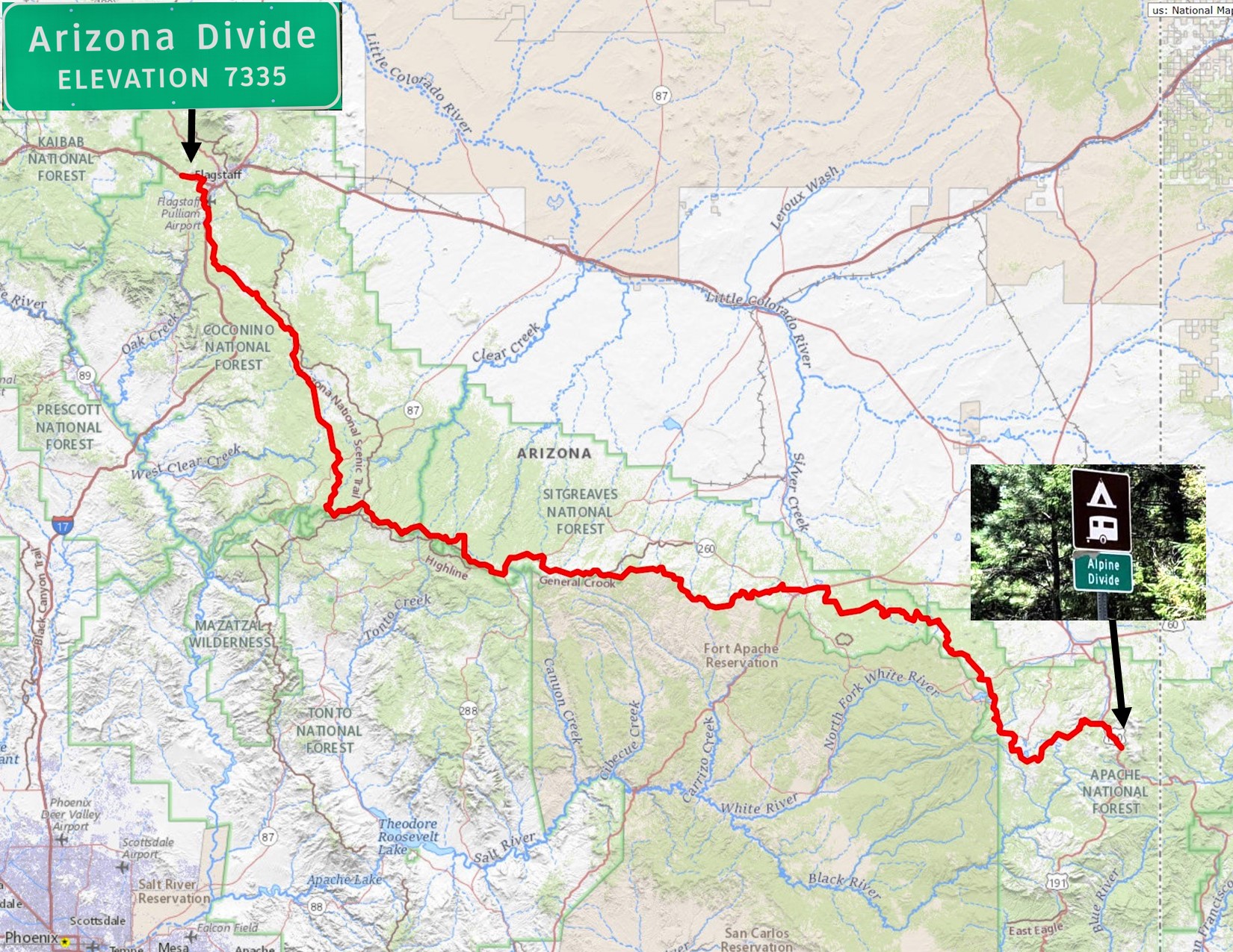
The Arizona Divide is a high ridge west of Flagstaff, marked by a highway sign along I‑40 at about 7,335 feet, where water decides whether it will ultimately flow toward the upper Colorado or toward the Gila and lower Colorado. North of the divide, creeks like Chevelon, Clear Creek, the Little Colorado, and the Puerco drain toward the upper Colorado River basin, while to the south, the Black, San Francisco, and Blue Rivers feed the Gila before it joins the Colorado near Yuma. In other words, this ridge is the hydrologic hinge of a huge portion of Arizona, quietly shaping where snowmelt and summer storms end up and how life organizes around scarce water in a dry state. Unlike the Continental Divide, the Arizona Divide never had a famous, continuous trail following its watershed line—until AZ Gravel Rides started stitching one together.
A Trail Built Around a Line of Water
The Arizona Divide Offroad Trail was created specifically to explore this ridge in a way you can feel in your legs and lungs, not just see on a map. Starting near the ADOT Arizona Divide sign on I‑40 and finishing at the Alpine Divide sign on U.S. 191, it runs about 270 miles, with over 75–77% of that distance on dirt and nearly 30,000 feet of climbing. It was designed as a bike route, but—outside of a couple of short non‑motorized sections near Flagstaff and Forest Lakes—it can be driven by high‑clearance two‑wheel‑drive vehicles, making it accessible to a wide variety of adventurers. Following that route, you’re not just traversing forests and high desert; you’re literally weaving along the knife edge that separates two massive river systems that sustain millions of people downstream. Every descent and climb hints at which basin you’re entering, and every creek crossing is part of a much bigger water story.
Landscape, Ecology, and the Feel of the Ride
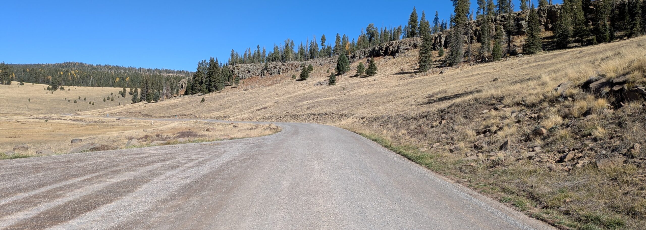
On the ground, the Arizona Divide Offroad Trail strings together a surprising diversity of landscapes for a single route that stays mostly in Arizona’s high country. To the north, the route crosses high desert and open country with sweeping views and very little human presence, a stark, empty-feeling expanse that reminds you how much of Arizona is still remote. To the south, it dives into the thick forests and deep canyons of the White Mountains, where elk, bears, and even wolves roam, and where the air cools and the smells of pine and wet soil replace the dust of the plateau. All of that is tied together by the relentless elevation profile: nearly 30,000 feet of gain over 270 miles means you’re constantly moving between microclimates, vegetation zones, and headwaters that feed two different river worlds. The physical effort becomes part of the story, tuning you into subtle changes in air, light, and terrain that you’d miss behind a windshield.
Connecting Towns, History, and Riders
The Arizona Divide isn’t just hydrology and scenery; it’s also a cultural seam, and the trail uses that seam to link a string of small towns and deep histories. Loops that incorporate the route, like “Ride the Arizona Divide,” visit communities such as Heber, Show Low, Greer, Alpine, Blue, St. Johns, Snowflake, Woodruff, Holbrook, and Winslow, tying together ranching country, logging heritage, Indigenous homelands, and railroad history. For modern riders, that means the trail becomes a moving conversation between remote backcountry and the people who call this region home. You pass from lonely ridgelines into quiet main streets and back again, seeing how water, elevation, and landforms have shaped settlement patterns, economies, and ways of life on both sides of the divide.
Experience Why the Arizona Divide Trail Matters Now
In an era when the Colorado River and the Gila are under intense stress, riding a route that physically traces the line between their headwaters and tributaries is an act of education as much as recreation. The combined flow from the rivers north and south of the Arizona Divide more than offsets Arizona’s 36% allotment from the Colorado River Compact, underscoring how crucial in‑state water sources and headwaters really are. The Arizona Divide Offroad Trail gives riders a direct, body‑level way to engage with those realities: to see where snow still lingers, where creeks run dry, where forests burn or regenerate, and where small communities live at the mercy of drought and monsoon. It transforms a green roadside sign and a thin contour line on a topo map into a lived experience—a multi‑day immersion in the geography of water, resilience, and connection that defines Arizona’s high country.
SUPPORTING PARTNERS
The Arizona Divide Offroad Trail route relies on the support, advice and encouragement from a variety of companies that help us maintain this route and provide resources to help plan this adventure for others to enjoy. We encourage you to support the companies that choose to give back to the community by supporting this adventure!