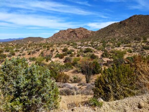
February’s featured ride is the Wikieup Loop starting at 17 Mile Road and Highway 93 55 miles north of Wickenburg (143 mile marker). Plenty of parking just off Highway 93 or you can drive a mile further north and park at the day use area for the Burro Creek Campground. The campground is a great place to stay if you’re planning a trip for a few days. Plenty of things to do. Make sure you hike back to the Kaiser Hot Spring located just a mile from the campground.
You’ll start out on 17 Mile Road to the intersection with Signal Road. At the intersection with Signal Road you’ll make a left and cross the Big Sandy River (usually dry). From there you’ll venture five miles to Coyote Way bearing right. The desert in this area is spectacular, one of the few places in Arizona where saguaros and ocotillos of the Sonoran Desert mingle with Joshua trees and flora of the Mojave Desert. After intersecting with Alamo Road you’ll proceed north until you reach Chicken Springs Road. After going up and over through the Hualapai mountains and the highest point on the course (elevation: 4300 ft.) you’ll arrive at Wikieup where you can restock if needed. After an eight mile ride along the highway you’ll make a right on Signal Road for the downhill spin back to 17 Mile Road. Saving the best for last you’ll enjoy a seven mile climb featuring two off the chart short sections before the final seven mile bomb back to the start.
The first 30 miles of the route is part of the Ride Across Arizona, the 615 mile gravel road route across northern Arizona.
Road Rating: Cat 2 (https://azgravelrides.com/arizona-gravel-road-rating-system/)
Information: https://azgravelrides.com/arizonas-best-gravel-road-rides/
GPS: https://ridewithgps.com/routes/38439204
Warning: Back-road travel can be hazardous, be aware of weather and road conditions. Carry plenty of water. Don’t travel alone, let someone know where you are going and when you plan to return. Consider carrying a Spot or Garmin Inreach tracking and com device.