About Ride Across Arizona
The 616 mile Ride Across Arizona is a cross-state gravel road adventure ride that we first documented in 2020. The route is made up of non-technical dirt, gravel and forest service roads with less than 20% of the route being pavement. The western end starts on the Colorado River at the California/Arizona border from the historic river settlement of Topock and finishes at the New Mexico border near the remote outpost of Blue Arizona. By the time you arrive at the finish you’ll have crossed deserts, windswept mesas and several mountain ranges. Unless you plan otherwise no one will be there to greet you at the finish, it is remote!
The Ride Across Arizona traverses through a cross-section of Arizona defined by spectacular scenery, a variety of landscapes, historic towns and remote wilderness. You’ll ride along the Colorado Plateau, the Mogollon Rim, San Francisco Peaks, White Mountains and Blue Primitive Area not to mention riding remote sections of the National Old Road Trail and Route 66. There are numerous campgrounds along the way and hotels can be found along the route at Seligman, Williams, Flagstaff, Forest Lakes and Show Low. The finish is near the beautiful Town of Alpine which has numerous places to stay.
Since 2021 my wife and I have made this a yearly ritual where we start at sunrise (6:00am) from Topock on the Cali border on the first Monday in May and ride non-stop until we reach the New Mexico border near Blue Arizona. This seems to be the best time of the year to ride. The temps are not too bad in the deserts and generally the forest service roads and campgrounds are open the 1st of May for the start of the summer season.
Ride Across Arizona – Topock to Bagdad
Distance: 115 miles
Elevation Gain: 11074′
Unpaved: 65%
GPS: https://ridewithgps.com/routes/49515014
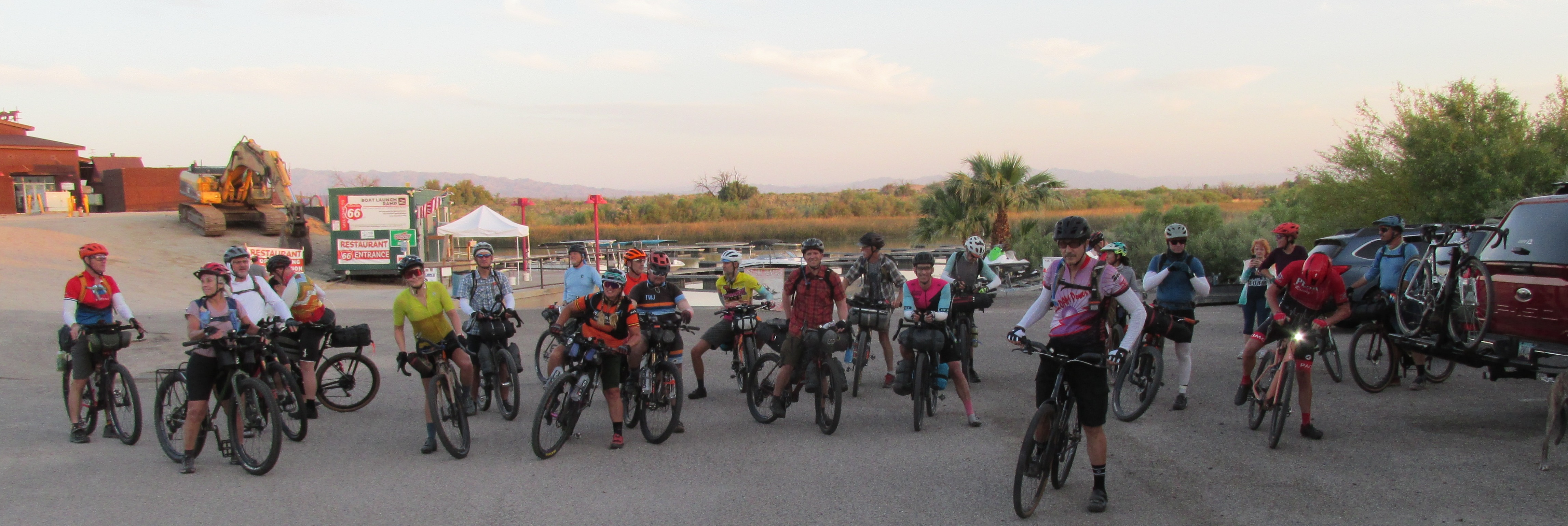
From the start at Topock Route 66 Resort on the Cali/AZ border along the Colorado River the first 13.5 miles follows I-40. This is a wide bike lane. From year to year it varies on how much debris exists. The last two years have been better. I personally ride as far to the right as possible.
After exiting at Francona Road you’ll hit mostly hardpack dirt. A lot of embedded rock so if you don’t have suspension you’ll definitely know you are not on pavement anymore. From Francona you’ll jump on an original and historical section of the National Old Trails Road. This was the original coast to coast highway opened in 1921. It follows a Native American trade route in use since 1100 AD that traverses from the Hopi village of Oraibi to the Pacific Ocean just north of modern day LA. It is the oldest continuously used road in the United States. Mostly rideable but there are a couple of short sections of sand that may require a dismount.
At mile 17.5 you’ll turn left on to a smooth super fast atv trail that connects with the paved Unna Road adjacent to I-40. Follow Unna for four miles before heading east on Santa Fe. After 6 miles you head south on Butch Cassidy Road. This is new for 2025 added to avoid a recently paved section of the Alamo Road. After riding five miles you’ll make a left on Fireside and then a short jaunt on Geronimo before you come up on Alamo Road. Now you are out in the boonies! Follow Alamo for 25 miles before turning left onto Signal Road. This is mile 65 of RAAZ. I like to remind myself that at mile 60 I have completed 1/10th of RAAZ! Signal Road is a fairly easy stretch if it’s been graded recently. Like Alamo it has pockets of sand that can interrupt your momentum but nothing too severe. Hopefully Mary will have a water station set up again for us at her ranch at mile 73!
After crossing the Big Sandy River the route changes to 17 Mile Road, one of the toughest sections of the entire RAAZ route. In the next seven miles you’ll do several climbs that exceed 30% but the reward will be at the top with sweeping views of the Burro Creek Wilderness and the Bagdad Mine as you begin an almost constant descent until you reach the Wikieup Highway at mile 88.
From that point the route remains paved until Bagdad. You do have an option to avoid some of the pavement although no one used it this past year. At mile 93 you can follow an 8 mile off road trail that eliminates nine miles of pavement. The first four miles of that route can be rather challenging but the remaining 4 miles consist of graded dirt that is usually in excellent condition. I can ride the entire first four miles but chose to dismount twice on downhills as I tend to be more cautious when riding alone.
Ride Across Arizona – Bagdad to Seligman
Distance: 94 miles
Elevation Gain: 9053′
Unpaved: 95%
GPS: https://ridewithgps.com/routes/49578964
Bagdad is a company owned town and there is no public lodging available. They do have a Basha’s grocery store and a Circle K where you can re-supply as needed. As you are leaving town, about a mile up the road, there is the Copper Country Bar & Grill. Great food and excellent service. This is your last chance to get a meal until you reach the Subway at Seligman!
After a 20 mile climb out of Bagdad you’ll enter Behm Mesa before passing through the historic Yolo Ranch at mile 24. The ranch encompasses over 110,000 acres of high-country land in Arizona. Established in 1885, they run over 1,500 head of cattle on some of the most beautiful and varied country in the state.
From there you will continue through the Ponderosa pine forest to Camp Wood before starting a 15 mile downhill to the northbound Williamson Valley Road. This section crosses a huge basin known as the Big Chino Basin. Basically a shorter version of the Tour Divide’s Great Basin through Wyoming. Pray that you have a wind out of the southwest! The closer you get to Seligman the more washboard you’ll encounter, you’ll be relieved when you finally hit the pavement.
Seligman is a cool little town located on the old Route 66. There are numerous restaurants, hotels and a KOA. We usually stay at the KOA, it is literally right on the route. If you love trains this will be heaven for you. Transcon is one of the most heavily trafficked rail corridors in the United States with an average of almost 90 trains daily (over 100 trains on peak days) passing through this section with each train typically 6,000 to 8,000 feet long.
Ride Across Arizona – Seligman to Flagstaff
Distance: 104.2 mi
Elevation Gain: 9011′
Unpaved: 85%
GPS: https://ridewithgps.com/routes/49691759
The 104 mile third section of the Ride Across Arizona travels from Seligman to Flagstaff. For me it’s a toss up with Alpine as my favorite section of the entire route. Even though it’s near very popular areas of the state for recreation (Grand Canyon, Williams area and Flag) it remains off the beaten path. Hardly any motorized vehicle traffic, it just feels very remote and their is abundant wildlife.
This route covers arguably the most historically significant area in the state of Arizona known as the 35th Parallel Route. This is the original Hopi trade route originating out of the village of Orabai, the oldest continually inhabited settlement in the United States (founded 1000AD). The ancient Hopi trade route passed through northern Arizona following a series of waterholes (including Russel Tank, mile 21) on its way to the Pacific Coast in what today is the Los Angeles area. This route is also associated with historical figures like Captain Lorenzo Sitgreaves and Lieutenant Amiel W. Whipple, who mapped the area in the 1850s for a potential railroad to the Pacific, and Edward Beale, who explored it with camels for a wagon road. The route crosses the state roughly between Winslow and Kingman.
You will eventually eventually connect once again with the National Old Trails Road which takes you into Williams. This section of the National Old Trails route also travels along the Transcon rail line. It is so awesome to be in the middle of nowhere and see and feel a big five engine 2 mile long train go rumbling by at high speeds (the rail is rated for freight speeds up to 90 mph!). Once in Williams you’ll find a Safeway store along with numerous hotels, restaurants and breweries. There are several USFS campgrounds in the area including Dogtown Lake Campground which is located on the route.
From Willams it’s onto Flagstaff, a mountain city located at 7,000 feet elevation within the world’s largest contiguous ponderosa pine forest, known for its four-season climate, outdoor recreation, and astronomy heritage. It is a central hub for exploring numerous natural and historical attractions in Northern Arizona, including the Grand Canyon. Flag has numerous hotels, bike shops, grocery stores etc. Plus!.. a Circle K right on the course!
Seligman, Williams and Flagstaff are all original Route 66 towns. Route 66 will celebrate it’s 100th Anniversary this coming year. Celebrations are planned so it’s a great time to visit!
Ride Across Arizona: Flagstaff to Forest Lakes
Distance: 118 miles
Elevation Gain: 12017′
Unpaved: 75%
GPS: https://ridewithgps.com/routes/49761016
Section 4 of the Ride Across Arizona stretches from Flagstaff to the community of Forest Lakes where Highway 260 intersects with the Mogollon Rim. The Rim is a 200 mile long escarpment defining the southwestern edge of the Colorado Plateau. You’ll have crossed two deserts and three mountain ranges before the start of this section across the Colorado Plateau. You’ll feel every bit of it too! Weather can be very unpredictable along this section. During the 2022 version of the event the leaders that year made it through this section with excellent weather. From the mid pack and back not so much. Wind gusts were recorded at 60 mph. At times it was nearly impossible to ride your bike, especially directly along the Rim. I pushed my bike into a headwind for a couple miles on the climb out of Clear Creek and was constantly needing to unclip in order to keep from getting knocked over from treacherous side winds along the Rim.
The route starts in south Flagstaff where there are a number of places to re-supply. Make sure you do. You won’t see another store until Forest Lakes. After leaving Flag the mostly dirt road meanders through the ponderosa pine forest before hitting the paved Lake Mary Road approximately five miles south of the Mormon Lake community. You’ll travel south on Lake Mary Road for 15 miles before jumping off on FS 211. From this point on you’ll be on dirt and gravel roads until the last three miles before crossing Highway 260. There are 40+ numbered primitive camp spots spread out along the 2.5 mile road between Hwy 260 and the Young Highway. Perfect place to spend the night.
Ride Across Arizona: Forest Lakes to Big Lake
Distance: 134.5 miles
Elevation Gain: 13941
Unpaved: 87%
GPS: https://ridewithgps.com/routes/49815223
The 134 mile (with nearly 14K of elevation gain) section 5 of the Ride Across Arizona 2025 stretches from the community of Forest Lakes to Big Lake. Starting from Forest Lakes you’ll once again jump on the Rim Road (FS 300) for a mostly downhill 60 mile cruise along arguably the roughest section of Ride Across Arizona. Geologists refer to this area as “Rim gravel”, referring to ancient gravel deposits often found on high plateaus in northeastern Arizona which are remnants from past erosion due to the uplift of the Colorado Plateau. From there you’ll jump on the pavement as you make your way through Show Low but not before you pass the Travis Walton abduction site. Forestry worker Travis Walton was allegedly abducted by aliens near RAAZ mile 442.5 on November 5, 1975 in the Apache–Sitgreaves National Forest near Heber, Arizona. Great camp spot too! Once in Show Low there are numerous places to dine and stay (campgrounds, hotels) plus a bike shop. After leaving Show Low you’ll hook up with the Maverick Off-road Trail and eventually on to FS-267/N3566. This is where the fun starts as you’ll begin the climb up to Green’s Peak and at an elevation of 9,572.8 feet the highest point of the entire ride. The views are astonishing and you’ll most likely have the chance to cool off sitting on a drift of snow that has not yet melted! After Greens it’s a ripping downhill to the next slight climb and before you know it you’ll be at Big Lake. There are five campgrounds, showers and a store at the lake. As we get closer to the May start I’ll contact them to get the store hours and the status of the campgrounds.
Ride Across Arizona: Big Lake to Blue
Distance: 51.4 miles
Elevation Gain: 5794′
Unpaved: 99%
GPS: https://ridewithgps.com/routes/49849490
The sixth and final section of the 615 mile Ride Across Arizona goes from Big Lake to Blue. It is 51 miles to the finish at the New Mexico border at the remote outpost of Blue Arizona. At mile 595 you will pass over the Coronado Highway, now known as US 191, which has a history stretching from the 16th-century Spanish expedition led by Francisco Vásquez de Coronado to the modern-day scenic drive it is today. Construction on the modern, 124-mile road through the Apache-Sitgreaves National Forests in eastern Arizona began in 1916 and was completed in 1926, replacing a longer wagon route. Initially designated as part of U.S. Route 666, it was renumbered to U.S. Route 191 in 1992 due to negative publicity associated with the “Devil’s Highway” nickname.
After crossing the highway you will enter the Blue Range Primitive Area: it is the last remaining federally designated “primitive area” in the entire U.S. National Forest System. All other areas with this original 1930s status were eventually reclassified as Wilderness Areas under the 1964 Wilderness Act. Because of its remote location, lack of development, and difficult access, the area receives very few visitors, offering exceptional solitude. The area is a vital habitat and part of the Mexican Gray Wolf Recovery Zone, home to black bears, mountain lions, elk, and a wide array of bird species.
For over 100 years the fight to prevent the Blue from being designated a wilderness area involves local ranchers who historically opposed the designation and continue to do so, citing concerns that wilderness status would impact their livelihoods and mining potential. Local ranchers, some of whose families have ranched in this area from the 1800’s, have consistently opposed wilderness designation, arguing it interferes with their use of the land, although the government has worked to acquire some of the private land in the area, which has reduced the number of permitted ranchers.
Remember there are no stores in Blue. There is a well stocked country store at Big Lake. That is the only place along this route to resupply. There are two small campgrounds near the community of Blue, the Blue Crossing Campground and the Upper Blue Campground if you don’t feel like riding into the town of Alpine. Both campgrounds feature Adirondack-style shelters plus a vaulted toilet. The Blue River has water but you will need a filtration system. That five mile climb to Alpine after re-entering AZ is a brute!