By Harry Johnson
 A few months ago, Craig Swetel, the co-founder/director (along with his wife Minnie) of the Chino Grinder Race, posted an event on the Riding AZ Gravel site that he called the “Ride Across Arizona”. Basically, Craig envisioned a bike ride across our beautiful state utilizing almost exclusively dirt and gravel backroads. The ride would start on the Colorado River, which forms most of Arizona’s western border and cross the state to the New Mexico border on the east. It would be about 600 miles and although it hadn’t been done yet, the route was mostly set, using maps, satellite images and local knowledge whenever possible. The ride would be self-supported and done at your own pace. I love these kind of “adventures” and my interest was seriously piqued.
A ride like Craig planned would not be as simple as your normal bike outing. It would take multiple days and much of the time you would be in the middle of nowhere with no cell service, towns or supplies. Fortunately, in my younger days, I spent a lot of time, organizing and leading climbing expeditions to remote areas of the world so I have a lot of experience planning for the “what if” scenarios. I went about planning the ride across Arizona in the same way.
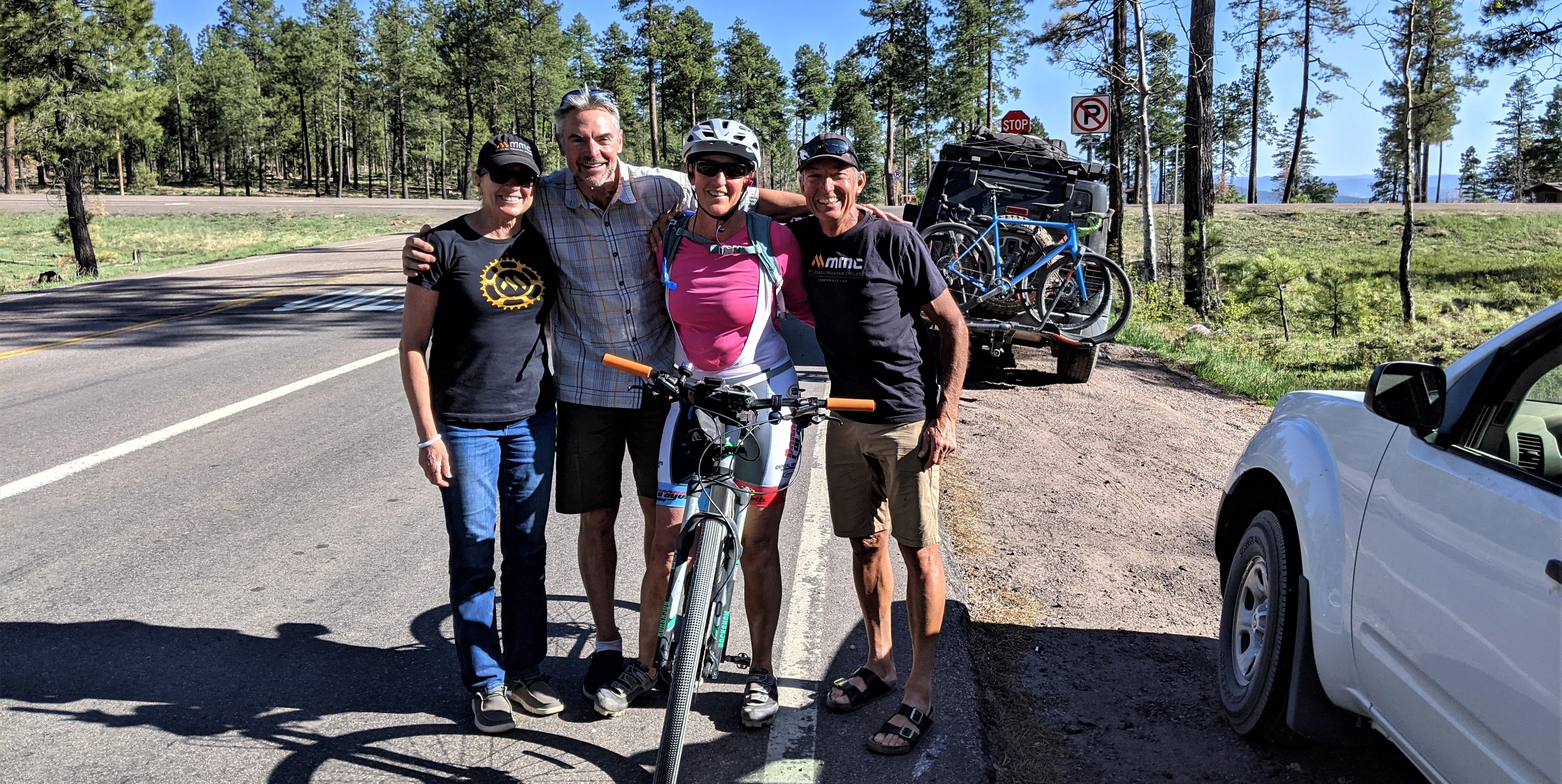
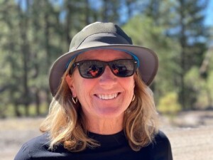 The most important part of being able to accomplish this route would be having someone willing and able to provide support along the way. I am truly blessed in having a girlfriend, Diane, that I have been married to for 48 years, and who is always up for another one of “Harry’s crazy adventures”. She would drive the route as much as possible and be the SAG (support and gear) wagon. Knowing I had Diane for support, the next focus was the route and Craig had already done the main work in laying the route out. GPX files were loaded into my Garmin and back up Garmin, the routes were recreated on Strava and loaded in my and Diane’s Strava account for backup and I bought hard copy maps of the roads that we would be following.
In addition to this planning, it would be critical to have anything and everything that we might need along the way. Camping gear, food and drinks, extensive toolbox, parts such as spare tires, sealant, tubes, chains, wheels, derailleur hangars and more were all organized and packed. Add cycling clothing for several days, chamois cream, warm/cold/dry/wet gear and your normal day to day stuff and we had a jeep full of supplies. As you might guess by now, the organization and preparedness for a trip like the Ride Across Arizona takes almost as much time and effort as does the actual trip itself. This is particularly true when you realize that this was just for me. Craig was doing all the same organizing and prep work to support his wife Minnie, who was also planning to do the ride.
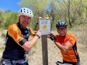
The actual ride was to start on May 3rd, but our granddaughter was graduating from high school in Montana on May 1st, so I planned to start a day late on May 4th. My long-time buddy from Alaska, Dan Wolf, was planning to ride with me and so Diane and I picked up Dan and his bike and gear on May 3rd and headed for the start in Topock on the day that Minnie started her quest. The following is my day by day recap starting on May 4th.
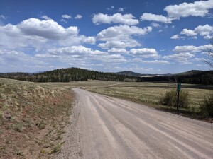
 Day One: We left Topock, on the Colorado River, at just after eight in the morning. Topock is only 456 feet above sea level, and it was already hot and windy. Unfortunately, the worst part of the entire route is the first 16 miles, where you have no choice but to ride the shoulder of Interstate 40 and you climb almost a thousand feet in elevation. At about mile 16, Craig had told us there was a place to crawl under/over the fence off the Interstate and gain access to an old frontage road. We were all too happy to squeeze through the barbed wire fence to escape the noise of the highway. For most of the rest of the day, we rode through the desert on relatively good, though a bit sandy, roads. About 65 miles into the day, we crossed the Big Sandy River, although there was no water, just sand, and turned steeply onto The 17 mile Road. Luckily, it was only 14 miles long, because it was rough, rocky and climbed steadily along the north side of the Arrastra Mountain Wilderness area. This 14-mile section of road would end up being the hardest section of the entire Ride Across Arizona. After finally reaching the summit, the road descended just as steeply down to highway 93, where I made the final descent into the Burro Creek Campground, where we would camp next to Craig and Minnie for the night. The final tally for the day was 81.7 miles, 6 hours in the saddle and just over 5,000 feet of climbing.
 Day Two: We knew that today would be long and difficult because we wanted to make it to Seligman, which was over 115 miles away so we got up at daybreak and started packing up camp so that we could get rolling. Craig and Minnie left before us and drove to Bagdad where Minnie had ended her ride the day before. Thirty miles into the day, we rode through Bagdad, and we wouldn’t see another settlement of any kind for the next several hours. The roads were generally good, but with some very steep rocky sections that Diane could barely navigate in the jeep. We climbed continually through most of the day and went through some beautiful mountainous areas along the Behm Mesa and into the Camp Wood area where pine trees overtook the high desert. A long descent from the Camp Wood area took me down to the Williamson Valley Road where I finally caught up with and got to briefly visit with Minnie (She is one tough Lady). I had forty miles to go to Seligman and about four hours of daylight to make it. The ride along Williamson Valley Road is beautiful with cattle, deer and lots of hills to keep you entertained. By the time I got within sight of Seligman, I was hot, tired and cranky and the sun was on its way down. Diane came and picked me up just three miles from town (I would have to go back the next morning and do those three miles.). The old Route 66 motel with the Hawaii themed room and no AC was a welcome refuge after a long day. The final tally for the day was 116 miles, 10 hours in the saddle and almost 10,000 feet of climbing.
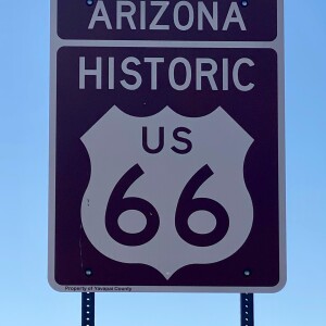 Day Three: After two hard days and my butt and my WHOOP telling me I needed some recovery, we decided to make an easy day of it. We visited Craig and Minnie at their campsite and then headed out on Route 66 toward Ash Fork and then headed north to the old National Road toward Willams. The road conditions were good all day and it was mostly flat, by my standards, except for a few steep little climbs on the National Road. It was awesome getting into the pine forest and cooler temperatures north of Williams. Williams is just under 7,000 feet in elevation, and we would remain that high or higher most of the rest of the Ride Across Arizona. The final tally for the day was 59 miles, just under 5 hours in the saddle and 4,000 feet of climbing.
 Day Four: Our goal today was to make it south of Flagstaff where we could detour a little off the route to a friend’s cabin for the night. We headed out of Williams and biked through beautiful pine forest and meadows on very good gravel roads. We passed a sign to White Horse Lake which was fun as that is the turnaround for the Chino Grinder, my favorite race. We crossed back over the Interstate at Parks and headed east to Bellemont and then took forest service roads up and through the mountains to the west of Flag, finally descending the Mars Hill Trail into Thorpe Park. It would not be the most direct route, but it was a beautiful ride into Flagstaff. I would guess that this part of the route might be changed in the future because of the lack of support access and added climbing and distance versus a more direct route south of town. We navigated through Flagstaff and the University district and south into the Fort Tuthill area where we were on some real single track for a short while. The route then crossed under the I-17 and heads south on the Old Munds Highway until it connects with Mountainaire Road and eventually Forest Service Road 700, which is bumpy and rocky. We called it a day after 75 miles, six hours in the saddle and 3500 feet of climbing.
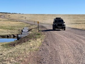
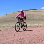
 Day Five: The riding from the Munds Park area along the forest service roads toward the Lake Mary Road was beautiful with lots of wildlife, including a Coati which crossed the road right in front of us. Unfortunately, it was Saturday and the number of people on ATVs far outnumbered the wildlife and made for a dusty few miles. Minnie would be smart and do this section during the week and see almost no people or ATVs. We had a nice midday ride along the Lake Mary Road and then turned east on forest service road 211, which we followed across the Arizona Trail and all the way to Highway 87. We continued through the pine forest along the Clear Creek canyon until we had to detour off FS95 because of a bridge washout. We then followed FS139 to the Rim Road. As most folks know, the Mogollon Rim Road is spectacular as it hugs the edge of the Mesa which drops steeply almost 2,000 feet to the valley floor below. Although windy, the Rim Road was a nice ride and we followed it all the way to Highway 260 and on to Forest Lake for our overnight stop. The section on 260 is bad, with lots of traffic and no shoulder. I know Craig is trying to find an alternative route for future rides. The final tally for the day was 89 miles, seven hours in the saddle and 5,000 feet of climbing.
 Day Six: The Rim Road from the Forest Lake area toward Show Low is beautiful, but very rough, rocky and rutty. It was tough riding and even tougher for Diane trying to follow in the jeep. Thankfully this section has beautiful scenery and we saw two herds of wild horses with newly born foals. After riding the Rim Road for most of the day, we turned off on to Joe Tank Road, which was a welcome relief with nice relatively smooth gravel. After several miles of nice gravel, we were on to pavement and traffic and into Show Low. I wanted to make 70 or so miles, so we rode through Show Low and continued toward Porter Mountain and Twin Knolls. It was windy all day and much of it was a headwind, so we were happy to call it a day after 70 miles, five and a half hours in the saddle and 4,350 feet of climbing. PLUS, it was “Mother’s Day” and I owed Diane a nice dinner out in Show Low.
 Day Seven: This was my favorite day of the ride, despite having a strong wind all day. The forest service roads were actual gravel, not dirt, and they were mostly smooth. Instead of a lot of smaller climbs, there were two BIG climbs, which I prefer. The first took us up and past Green Peak which is close to 10,000 feet high. Then we descended over 2,000 feet, some of it with a tail wind pushing my top speed to over 50 mph, toward the town of Eagar. Just before Eagar, we turned south and climbed back up to over 9,000 feet where we would stay for the rest of the day. The roads continued to be great, the vistas beautiful and we saw mule deer and elk. Yeah, the wind sucked, but it was a beautiful day. The final tally for the day was 72 miles, six hours in the saddle and almost 7,000 feet of climbing.
 Day Eight: We could have kept going yesterday and suffered a very long day to the finish, but we decided to make our last day relatively short and fun. Just like we had enjoyed the day before, the forest service roads continued to be great all the way to the junction with highway 191. When we reached 191 we continued onto Red Hill Road, which had some construction underway repairing a washed out area. We had a short detour/delay and then continued on Red Hill Road until it plummeted over 2,000 feet in an eight mile section. It was a bit rough, super steep and curvy and exhilarating to say the least. For Diane driving, it was plain scary. The road finally quit descending at the Blue River at below 6,000 feet. It was the lowest we had been since our second day, and we had a short eight miles of steady climbing along the Blue River to the Arizona/New Mexico border. Overall a very fun day with a final tally of 51 miles, four hours in the saddle and 3,000 feet of climbing AND 6,000 feet of descent.
Our Ride Across Arizona was a great experience and mostly great fun as well. If you have the time and desire to do such an adventure, go for it……or how about picking a day or part of a day and getting out and exploring the route. The Riding AZ Gravel camp is this July up in the high country of the Arizona/New Mexico border. All are welcome and it will certainly be a fun time in a beautiful area of our state. Info is on the Riding AZ Gravel site. However or wherever you like to ride your bike, follow your dreams and sense of adventure and remember “There is NO one way to ride a bike”. Pedal Well, Harry
 Note: Minnie did the entire route solo, with Craig’s SAG support, finishing in 12 days and six hours. A special thanks to her and Craig for visualizing and creating this great adventure and a very special congratulations to Minnie for completing such a great ride.
Hary’s Ride Across Arizona by the Numbers
Days: 8 days
Riding/Saddle Time: 49 hours and 46 minutes
Average Riding Time each Day: 6 hours and 14 minutes
Longest Day in Saddle: 9 hours and 59 minutes
Miles: 612.01 miles
Average miles each day: 76.5 miles
Longest Day: 115.6 miles
Average speed: 12.30 mph
Maximum speed: 50.2 mph
Elevation Gain: 40,708 feet
Highest Elevation: 9,478 feet
Average Heart Rate: 110
Maximum Heart Rate: 157
Average Power: 137
Maximum Power: 534
Calories Burned: 21,832
Derailleur Shifts: 5,698
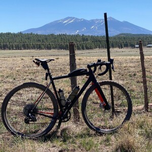
Bike: OPEN, model UP
Wheels: ENVE G23 700c
Tires: WTB Nano 40 Tubeless
Drive: SRAM Red shifters/brakes with SRAM X1 AXS derailleur
Chain Ring: 42t
Cassette: SRAM Eagle 10-50
Power Meter: QuarqDZero
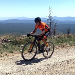
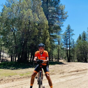
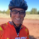 About the author: McDowell Mountain Cycles Harry Johnson is one of only two people that have completed every 100+ mile option of the Chino Grinder – Arizona’s Original Gravel Grinder since its inception in 2014. He is also the former Unbound Gravel 60+ Champion and Gravel Worlds Masters Champion. Upon his completion of the inaugural 615 mile Trans-Arizona Off Road Bicycle Route (aka Ride Across Arizona) he had established the FKT for the course at the age of 66!