For those that follow this site or our social media accounts you know our passion for discovering and exploring remote areas to ride in. Our latest adventure took us to the Town of Clifton Arizona located in the southeastern section of the state. We were looking for something remote and we definitely found it in Greenlee County, the least populated county in AZ. After doing some preliminary research of the area we decided on three areas to explore; Upper Eagle Creek, the Lower Blue and the San Francisco River.
Upper Eagle Creek Road (FS 215) GPX
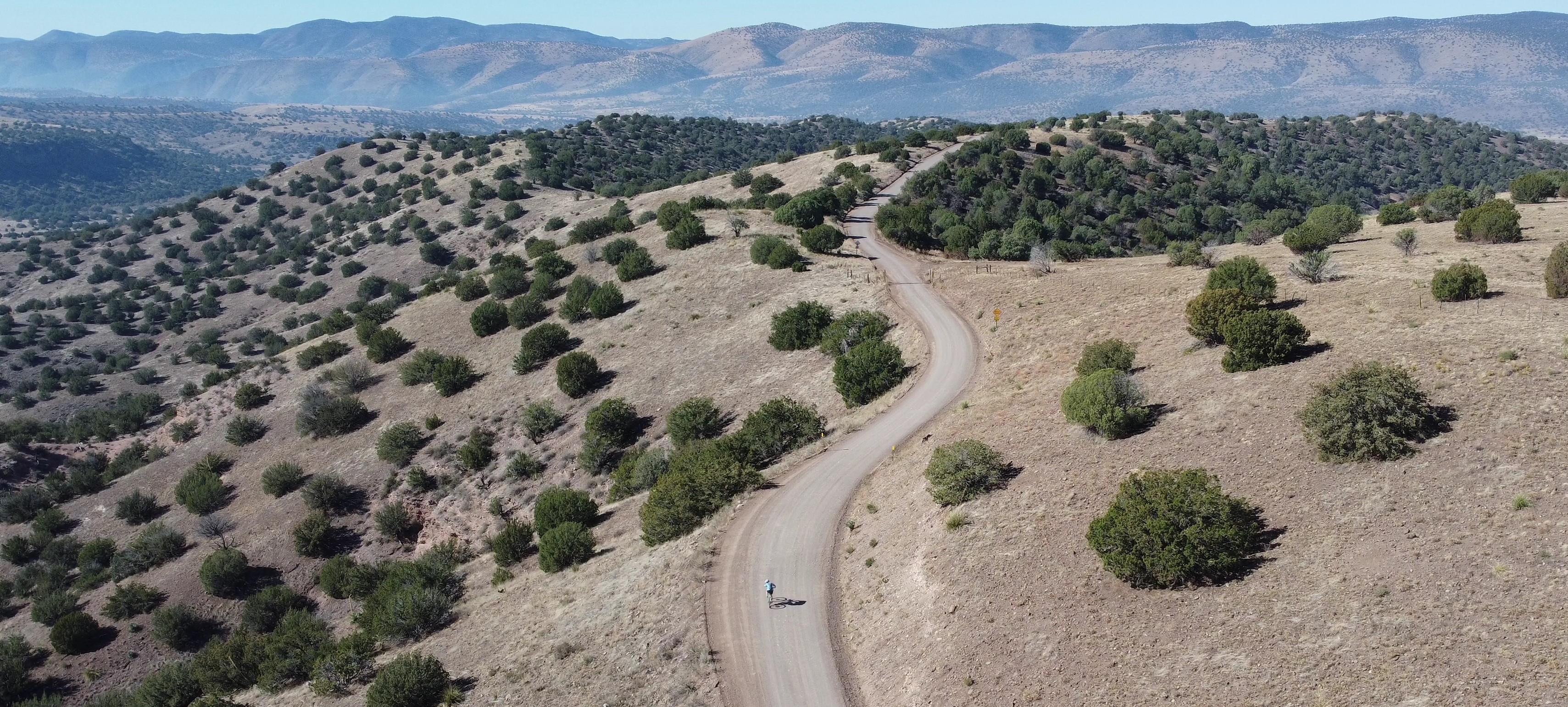
From Clifton we drove 28 miles north on Hwy 191 to the intersection with Upper Eagle Creek Road. There are several parking areas near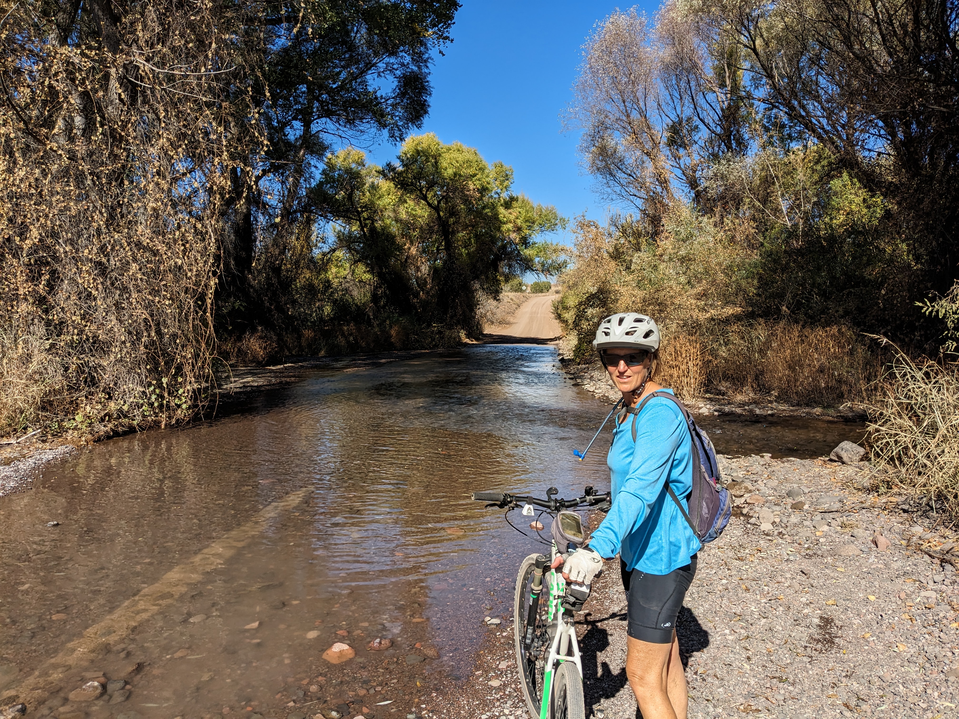 the start of the ride. The first 10 miles you’ll drop from 6300 feet to 4800 feet in elevation. The remaining 12 miles of the ride is a gradual uphill to the end of the road at Honeymoon campground. During the entire length of the ride I would guess there are about 25 residences. Public utilities do not exist, each ranch is self sustained generating their own electricity and all water comes from wells. There are three water crossings of Eagle Creek, a foot deep at the most. At mile 22.5 we came to Honeymoon Campground and the end of the road for motorized vehicles. East Eagle Trail #33 (open to mountain biking) continues on for 12.6 miles to Hwy 191. If you decide to give this trail a try the first 6 miles is an old jeep road. There is a cabin, Sawmill Cabin, at 7.5 miles. This cabin is maintained by the grazing permit holder but is open to the public. The entire length of this road is very well maintained with little motorized traffic.
Juan Miller Road (FS 475) GPX
Located just a couple miles north of Upper Eagle Creek Road this road provides access to the lower Blue River Area. We found the entire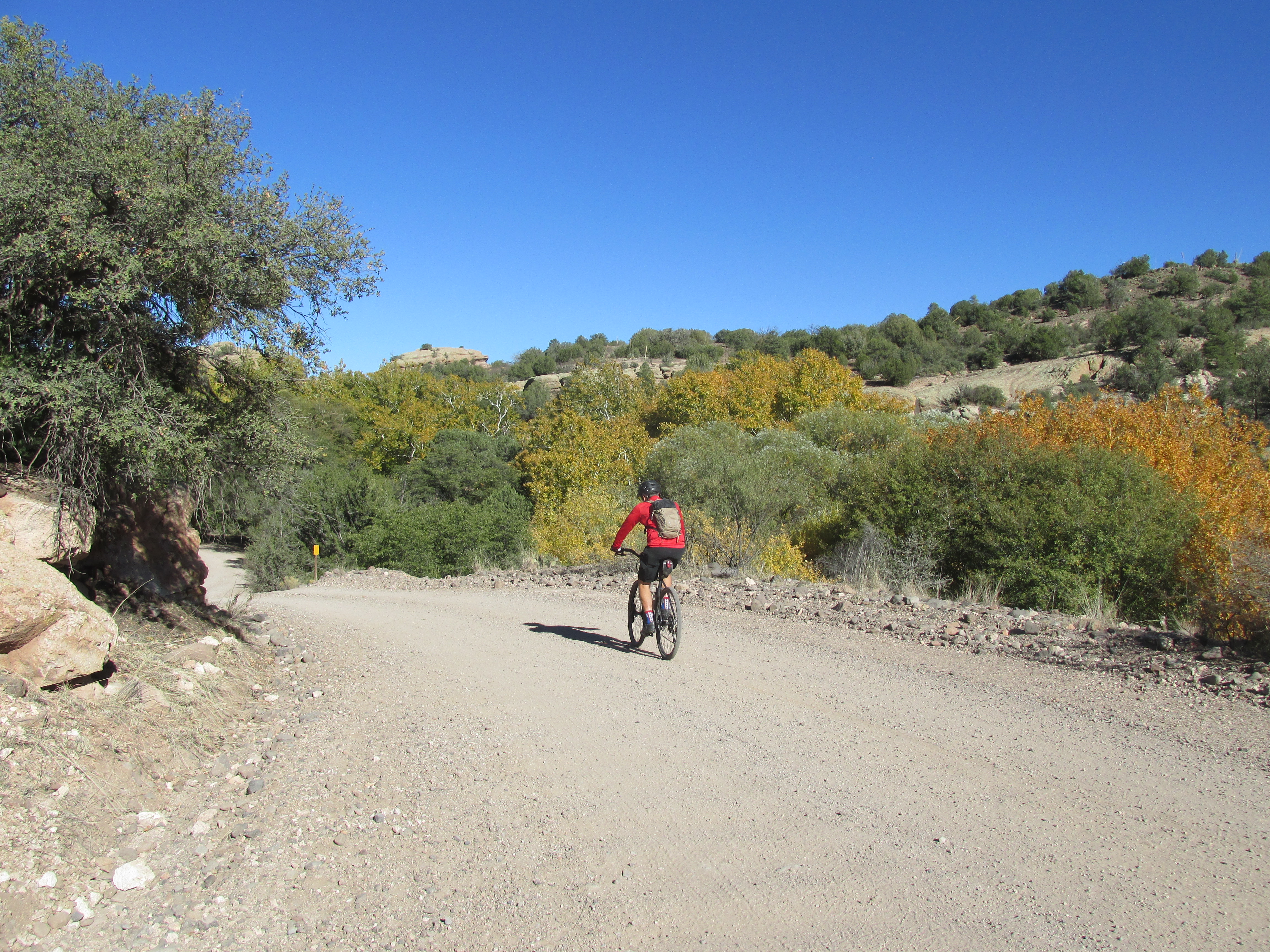 13.6 mile stretch of this road in perfect condition. Starting at 6000 feet it’s mostly downhill until you bottom out at the Blue River crossing at 4000 feet. The road continues on to a ranch but we turned around at this point. There are two campgrounds near the start of this ride, Upper Juan Miller and Lower Juan Miller, that are open year round. Near mile 12 is the road back to the abandoned XXX Ranch. Built by one of the first settlers of the area, Fred Fritz, the ranch is now maintained by the Forest Service and is open to the public. In 1899 Fred Fritz was attacked by a grizzly bear in nearby Maple Canyon and barely survived. You can read the story here. His son Fred Fritz Jr went on to become the only person to have served as Senate president and Speaker of the House for the State of Arizona. For an interesting view of life in this area in the early 1900’s you can read a transcript from an interview he did shortly before he passed away in 1981. Link to interview.
San Francisco River Road GPX
The San Francisco Road was once part of the Blue River Road. Built in the late 1800’s it followed the bed of the Blue River until it 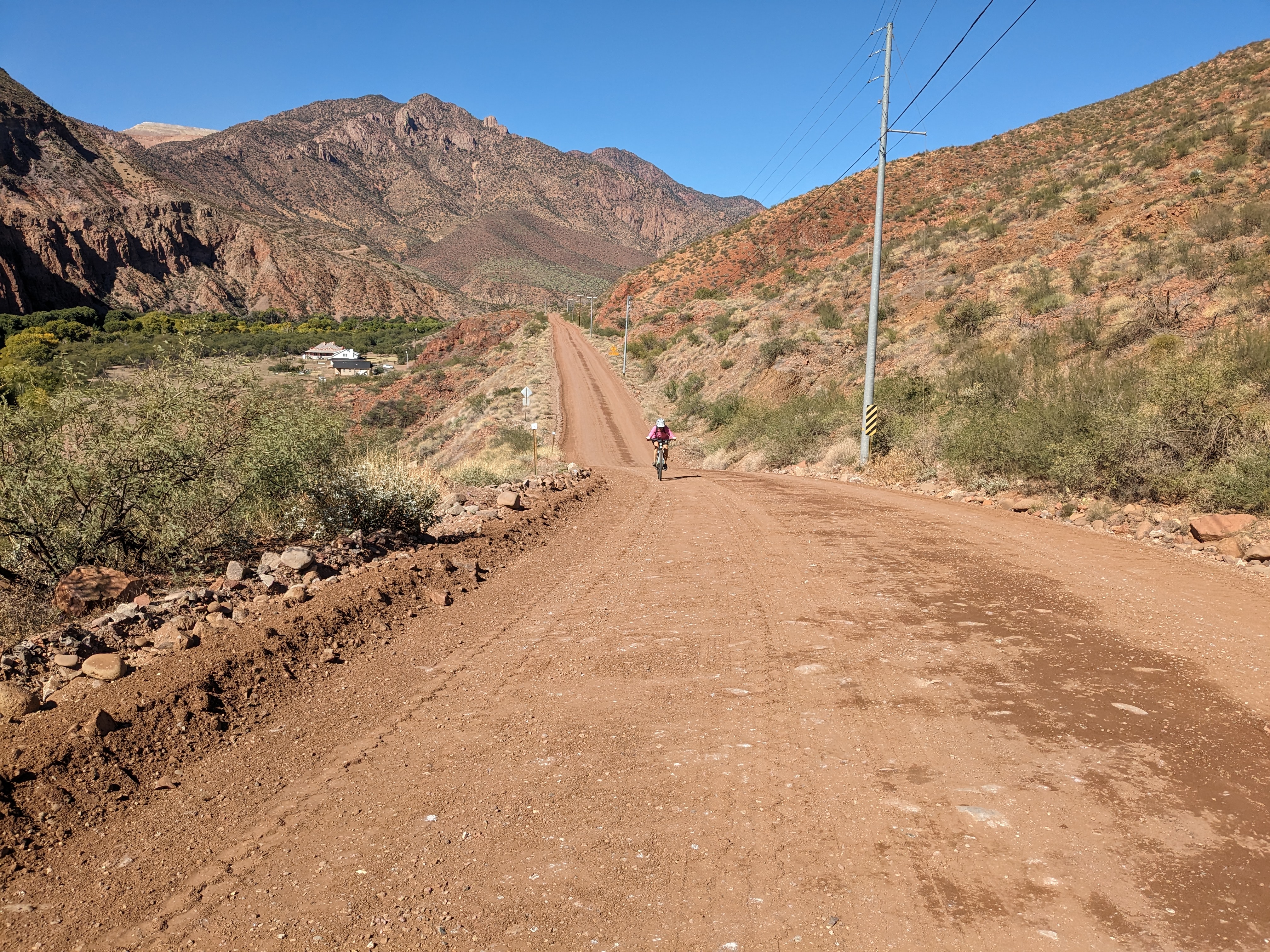 connected with the San Francisco River and from there into Clifton. Floods were a constant problem in keeping the road open. In 1916 the Federal government mapped out three potential road sites for a new highway. The existing Blue River Road, a route following Eagle Creek and the divide between the Blue and Eagle drainages. They decided on the divide route, because this route was the sixth link into Route 66 it was assigned a number which would haunt the road, motorists and locals for decades: US 666, the Devil’s Highway (re-designated to its current number, 191, in 1992). The Blue road continued to be used by local residents. In 1933 the federal government created the Blue Primitive Area which banned motor vehicle travel on the section between Twin Springs Canyon and Maple Canyon even though private ranches and homesteads fell within this area . The county and local residents refused to stop using the Blue River Road and the battle still goes on even today. That’s why it is the last remaining primitive area, all other primitive areas were changed to the Wilderness designation.
Questions about the existence of the Blue River Road remain unresolved to this day. What is clear is that, whether or not there is a traversable Blue River Road for the length of the river in Greenlee, the County nevertheless claims a right-of-way up the Blue—and that the Forest Service disputes that claim.
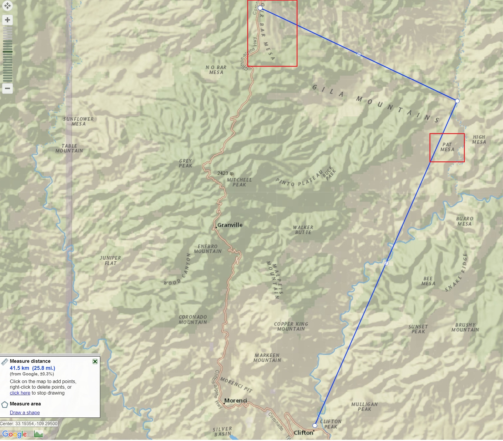
Potential re-route of Highway 191
Oddly enough due to the continued expansion of the Morenci Mine Highway 191 may eventually shift back to the Blue River. With preliminary plans for the highway to go up the San Francisco River where it will climb to Pat Mesa and rejoin the current highway at Four Bar Mesa eliminating many of the twists and turns the legendary highway is notorious for.
” Improvements and rerouting will continue and at some future time the winding old Coronado Trail may surrender to the villain named progress.” USDA FOREST SERVICE SOUTHWESTERN REGION ALBUQUERQUE, N.M.
References:
https://www.eacourier.com/copper_era/news/freddie-fritz-a-legend-who-lived-here/article_650c5648-8dff-11e3-ac04-0019bb2963f4.html
https://hub.arcgis.com/pages/b246fe92b8194905978d3145406a249e